
What we capture
Reality capture for BIM & VDC
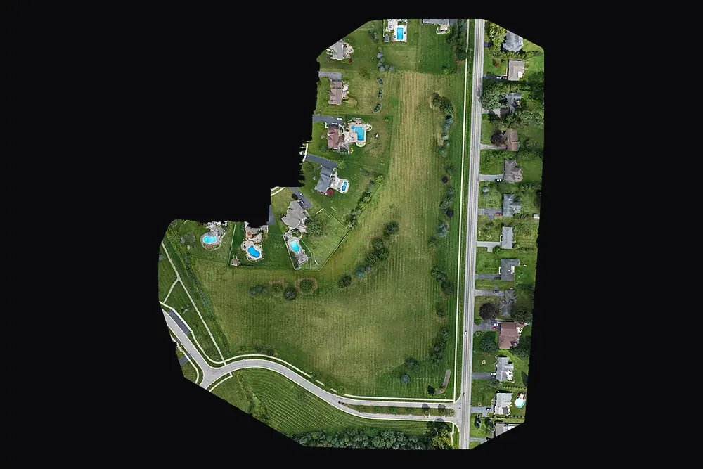
Point clouds, 3D meshes and orthomosaics of existing conditions and progress, aligned to your project control.
Learn more →Construction progress documentation
Monthly aerial photos, video and maps from the same positions, for owner reports and the project record.
Learn more →Drone mapping & site maps
Orthomosaic maps you can measure on, as GeoTIFF and Google Earth KMZ, fitted to your project control when you need it.
Learn more →Infrared roof moisture surveys
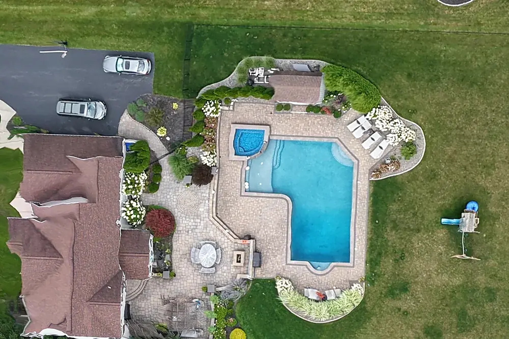
Find wet insulation under flat and low-slope roofs so you repair the wet section, not the whole roof.
Learn more →Building envelope survey
A complete infrared survey of walls, windows, doors, ceilings and floors, documented for insurance, warranty and public work.
Learn more →Drone roof inspection reports
Every slope and ridge photographed from above and annotated in a PDF. No ladder. $95.
Learn more →Land & acreage aerials
Aerial stills, approximate parcel lines and an orbit video for land listings up to 10 acres. $475.
Learn more →Real estate drone photography
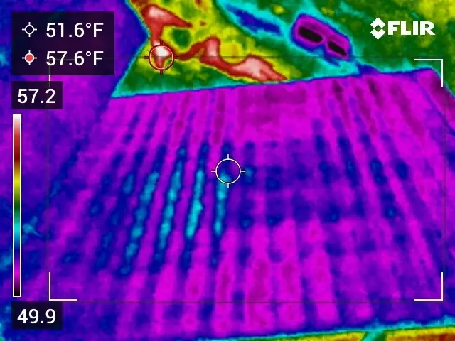
Listing aerials, ground sets and films from $199. City and near-airport addresses included.
Learn more →General contractors · BIM / VDC
Reality capture your BIM team can actually use
Your model shows what's designed; we capture what's actually there. Each flight produces an orthomosaic, elevation model, point cloud and textured 3D mesh of the site, fitted to the control your surveyor of record has set and delivered in open formats (LAS/LAZ, OBJ, GeoTIFF, KMZ) for ReCap, Navisworks, Civil 3D, Revit and Procore. Capture existing conditions before design and bid, then fly the same plan every month to compare the work in place against the model and the schedule.
Reality capture for BIM · Construction progress · Drone mapping & project control · Land & acreage
Thermal
Find the wet roof insulation before you replace the whole roof
Wet insulation under a low-slope roof holds the day's heat longer than dry insulation. Surveyed at night after a sunny day, the wet areas show up warm. We outline them on the roof and on your roof plan, your roofer confirms with small core samples and repairs only those areas, and we come back to verify the repair.
Thermal work is led and reported by Doug Lancie, an Infraspection Institute Level I Certified Thermographer (sUAS), Cert. No. 20483-D.
Infrared roof moisture surveys · Moisture scans for ice dams · Building envelope surveys
Real estate
Listing aerials, city addresses included
Most Rochester listings have no aerials at all. Much of the city sits inside the Class C airspace around Greater Rochester International, and a lot of operators simply skip those addresses rather than file the FAA authorization. We file it ourselves, at no charge, and fly the address.
Every package covers the property properly: all four elevations, the approach, the lot and the setting, edited and delivered as MLS-sized and web-sized files. There's no per-photo charge and no "pick your favourites" step.
Why people call us
- Controlled airspace is routine. FAA authorization near the airport is filed in-house, before the day, at no charge.
- Data that lines up. Captures fitted to your surveyor's project control, with a check-point accuracy report, so they land where the model does.
- Open files, no lock-in. GeoTIFF, KMZ, JPEG, PDF and MP4 that drop into Procore, DroneDeploy, Autodesk or your MLS.
- Straight answers. If you need a licensed land surveyor instead of a map, or the weather won't give you a good result, we'll say so.
- Certified SDVOB. New York State Service-Disabled Veteran-Owned Business #269133. Subcontracted work counts toward SDVOB participation goals.
Common questions
What areas do you serve?
Are you licensed and insured?
Can you fly near Greater Rochester International Airport?
How do I book?
Where we fly
Based in Irondequoit and serving Rochester and Monroe, Wayne, Ontario, Livingston, Orleans and Genesee Counties, including Irondequoit, Webster, Penfield, Fairport, Pittsford, Brighton, Henrietta, Greece, Gates, Chili, Hilton, Spencerport, Victor, Canandaigua, Brockport, Honeoye Falls, Sodus, Williamson, Geneseo, Batavia and Albion. Travel beyond 25 miles of Rochester is $0.75 per mile. FAA airspace authorization near Greater Rochester International is filed by us at no charge.